
Saturday, March 31, 2012
Calling All Creative Minds
Well folks, there you have it. Pictured below, (artfully presented by my 101 yr. old grandmother's hand), is the last of our winter squash from Full Belly Farm, our CSA. The question is: what do I do with it? It has adorned my table in a basket for the last couple of months, while its less flashy companions have been eaten; sauteed, roasted, in soups, in curries. I'm pretty proud of myself that this is the last one, because frankly, I'm more of a summer squash gal. I have to be honest though, my friend, Makini, has taken a couple of them off my hands. But now here I am left, end of the season, uninspired, with one last squash of indeterminate variety. So what is it to be? Food? Household decor? What?
 Calling all urban farm girls, crafters, and culinary geniuses! This includes guys, too, (although I don't think I want to blow it up, or drop it off a tall building...but I'm open). Post your ideas in the comment section. I will pick one, and show you the result here in this blog. Sooner rather than later, please, because although they keep for months, I think the clock is ticking on this specimen.
Tuesday, March 20, 2012
Recipe for Adventure
 Three weeks ago, on the last weekend in February, our family embarked on a long awaited trip to Death Valley. I have been curious about Death Valley for years, with a name like that what could have possibly been the allure for people? Before my son was born, I even went online to try and map out a quick south easterly weekend road trip there. What I yielded was a route showing that there was no such thing from my San Francisco Bay Area home--, it would take nine hours each way. So I gave up on the idea...temporarily. Then, a few months ago, the fiancee of my husband's best friend, who is, incidentally, a Park Ranger at Death Valley National Park, told us about a children's education program she runs at the park. She is a geologist, and my child is in love with all manner of Earth Sciences. Well, I thought, as a homeschooling mom, it's my duty to provide stimulating opportunities for my child to learn, is it not? So now we had a reason other than my burning curiosity to visit. We had to go in the name of education. Yea homeschooling!
At the time our friend told us about her program she had about a year left before she planned to leave her position and move to another park closer to the home she and her fiancee will be making. The best time to visit Death Valley is in late winter/early spring so we settled on a late February date. The excitement built as we talked to various friends, seeing who wanted and was able to participate. Again I turned to technology to help me map out our trip, my GPS said we should take the majority of the nearly 9 hour trip on Interstate 5, booorrring, but apparently necessary. I sat with that a while but then decided to check out another mapping website. This one came up with a route involving Highways CA120, and CA395. This route passes Yosemite, King's Canyon, and Mono Lake. Pretty and not at all boring. Best of all, it clocked in with less mileage and only slightly more time than the less appealing route. I discussed it briefly with my husband and with our good family friends who would be caravaning with us. We decided to take the pretty route.
Friday, the morning of our first day, our family( my husband, 7 yr. old son, 101 yr. old grandmother, and I) planned to leave at 5am. Right. My fabulous longtime friend The Miss, who was coming along with us in part to stay with my grandmother at the hotel while the rest of us camped, arrived from a long drive down from Lake Tahoe promptly at 4:50 am, as promised, like a trooper. She took a snooze on the couch while we packed up the car. Our co-caravaners arrived, surprisingly at 6am, (they are a family of two parents, a 10 yr. old boy, 7 yr. old girl, and 10 month old baby girl). We finally got everything squared away and pulled out from our curb at 7am. Alright, alright-- 7:30.
In spite of our "late" start it was still early in the day and we planned to pull into Death Valley at around 4:30 in plenty of time to set up camp. Well, as they say. If you want to make God laugh,--make plans.
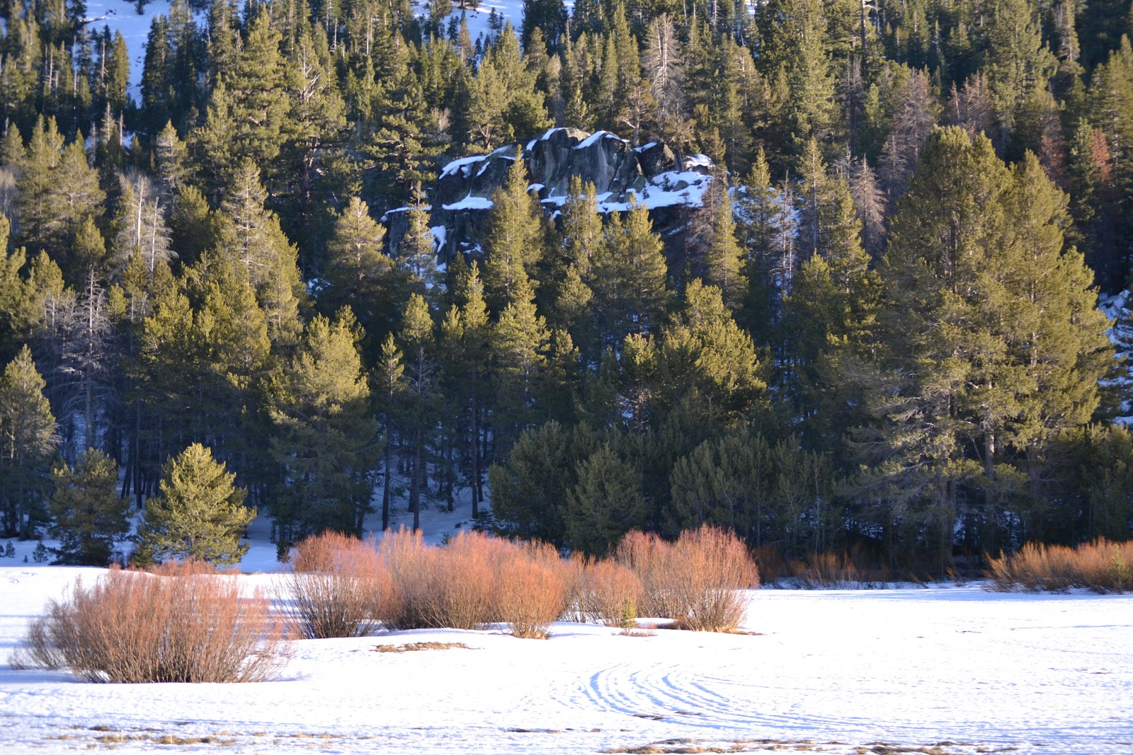
At this point, to appreciate what we did you really should have a California road map in front of you. Anyway, we set out from Oakland on Interstate 580E which would take us to Hwy. 120E which leads to the Hwy. 108E which borders Yosemite National Park. From there on to Hwy. 395S, which would take us most of the rest of the way to the park. Since the weather was clear, and we have had an extremely mild winter, we really weren't thinking about snow. At. All.
For those of you who don't know, the reason the a trip through central California on Interstate 5 can be so mind numbingly boring is because it is flat, with virtually nothing to look at. Now before everyone gets all up in arms about this area being where we get the majority of our food from here in the Bay Area, mind you, I didn't say it was worthless. Don't get me wrong, I'm grateful for all the hard-working farmers and ranchers out there. There is plenty going on out there, you just can't see it from the road. On the other hand the route we chose is full of orchards, quaint old towns, and rolling foothills. I was especially looking forward to the foothills. What I forgot about was that foothills usually precede mountains, in this case the Sierras, which even in this mild winter had road closures due to snow. Whoops.
 At about Oakdale we started seeing the Caltrans signs about winter road closures, naming the various passes that were closed for the winter. As we progressed we hoped against hope that Hwy. 108 was not among them. Alas, this was not to be.
We decided to stop in Sonora to take a bathroom break, bust out the snacks, and plan a re-route. We thought we could ask the locals the best alternate way to Hwy. 395, since our GPS was totally flailing, which it had been since about Modesto. Easier said than done. First we tried to find a chamber of commerce, no luck. Then we went to the outdoor store,-- completely unhelpful. No visible public restroom, or open taqueria to make a small purchase and use the facilities. We even asked the lady sweeping up outside the Waldorf education supply store if some fellow homeschoolers might prevail upon her good graces. She gave us some lame excuse about the owner,(she and whom, we suspect, were one and the same), so no luck there either. We finally went to the Valero gas station, no restroom but one really helpful customer directed us to Hwy. 99 which parallels the 5 and would lead us to Bakersfield and from there to the Hwy. 178E, then to Hwy. 395N, and on into the park on Hwy. 190. We bought a paper map, just in case, and thanked them profusely. We ate some yummy sandwiches that my husband had made while deliberating with our friends. They thought that we ought to take a chance and head north on the 49 to Hwy. 88 east through the mountain passes that would lead us to the 395S. That way we would still get our gorgeous scenery. So after a trip through a tweaker infested park to the bathroom, we left Sonora at about 1pm headed north. When we had cell phone service, we called Caltrans to check that the road was open, and it was.
We encountered snow, but only the scenic kind. The road was clear, we crossed into Nevada where we reached Hwy. 395 and finally began traveling south. I took a bunch of pictures before nightfall, unfortunately we passed Mono Lake just about an hour after sundown. So we decided to hit that on the way back. ( Again, sound of God laughing in the background.)
Around 10pm we pulled onto Hwy. 190 which goes into Death Valley. Much to the surprise of my grandmother who said, "oh I thought we had given up on that". Mind you, the whole way she never complained. Not once. From the entrance to the park it is about 60 miles to the hotel where my grandmother and The Miss were staying. Even after all that time on the road we couldn't help being fascinated by this last leg of the drive. It was pitch black, so what was on either side of the winding road was a mystery. We, of course, imagined huge drop offs. At one point, a burro materialized by the side of the road, out of nowhere. I said pitch black, this is not exactly true, a million stars --- Orion, the Big Dipper, and many more constellations whose names I should know, but don't, were visible. It was astonishing. When we pulled up to the hotel at 11pm we quickly decided that we didn't want to continue the remaining 20 or so miles to the campsite. So, when we went to the front desk to check my grandmother and The Miss into their room, we tried to get another room for the other family. The hotel was completely booked. So---all of us, all 10 of us, went to sleep for the night in the one room that we had.


For the next two days, all of us, adults and children alike, under the guidance of our awesome Park Ranger friend, learned about the geology and history of this beautiful place. We hiked a marble -walled canyon at midday and sand dunes at sunset. We walked out to the lowest point in North America and toured a seriously eco-conscious old mansion know as Scotty's Castle. We endured wind at our campsite that literally ripped our tent a apart, and threatened to temporarily do the same to our marriage. (Or at least in the heat of the moment at 3am it seemed like it.) We learned that "Death Valley" is just the name that some very unfortunate Caucasian pioneers who were passing through gave it. Timbisha, is what the Timbisha Shoshone people who have lived there successfully for more than 1000 years, call it. It means "red rock face paint". Though our visit was brief, I found that name to be more accurate and preferable for such a wondrous place. See for yourself, in the pictures I have posted here.


Trip home was equally crazy. We were determined to see Mono Lake, so again we opted for Hwy. 395N over Interstate 5N--- and we almost got away with it.
There were low clouds, but no rain as we pulled out of Timbisha (from here out I refuse to call it by such a negative name) at about noon. Driving out we witnessed the colors of the desert in full force, red, browns, gold, and yes even green. No burro this time, but we discovered the drop offs we imagined were mostly, non-existent, emphasis on mostly. As we drove through the Panamint mountains we could see the clouds gathering over the Sierras, but we weren't worried because we planned to check the road conditions at the Inter-agency Visitor's Center in Lone Pine. From there we could go either direction on 395 and get home. By the way, that place is really cool and the staff a very friendly. We bought a giant relief map of California, as a reminder to never again forget about the Sierra's when heading east from the Bay Area. Even though we could now see that it was snowing in the mountains, the current information had all roads that we needed to get home listed as open with no restrictions. We continued north on Hwy. 395 stopping around 2:30 for a late lunch in at Jack's in Bishop which is about 60 miles from Lone Pine. We ate some good home style food, bought some dessert for the road and an hour or so later we continued north towards Hwy. 50 from which we planned (there's that word again) to connect to Hwy. 80 and cruise on home to Oakland. But no, about a half hour out from Bishop we saw it, --the sign stating that only vehicles with 4 wheel drive or chains were allowed on Hwy. 50. Guess what we didn't have? Again, this was a trip to the desert and anything to do with snow had totally slipped my mind. Our car has 4WD capability, but according to my husband it's not "real" 4WD. So we quickly texted our friends to see if they had seen the sign, service out there is spotty so we didn't get an answer right away. By the time we did, it had begun snowing where we were and we decided to double back and take the highway south, cut across on Hwy. 178 to Bakersfield then go north on the 5 or the 99. This would add about 4 hours to our trip, and so much for seeing Mono Lake. Well, at least we had pie. Our friends who had left about 10 minutes before us decided to stay with the route they were on.


Hwy. 178 is winding anyway, and in the rain it was even slower. My son had a mini meltdown, and frankly by the time the GPS sent us in circles twice trying to find the on ramp for Hwy. 99 I felt like it too. All The Miss said was that she had planned on adventure and that she had allowed two days for travel. Fabulous! We finally walked in the door of our house at 1:45am safe and sound, our friends had made it home shortly before midnight.
En route to and from Timbisha we circled most of Central California and travelled a total of approximately 30 hours, it was supposed to be about 18. It could have been a nightmare, but it wasn't. What I know is that everything happens for a reason. Perhaps in our misguided meandering we avoided an accident, or saw something that sparked a conversation that we wouldn't have had otherwise. What I learned is this: When you set out on a journey, whether it be actual or metaphorical you need three things; accurate information, a sense of humor, and most importantly the right people. Plenty of good food and camera are pretty helpful, too.
Subscribe to:
Posts (Atom)